
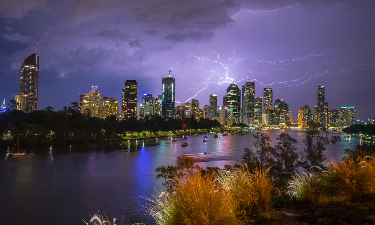
Australia Braces for Stormy Heatwave: Flash Floods, Hail, and Scorching Heat Ahead

Australia Faces Intense Weekend Weather: Thunderstorms, Flash Flooding, and Extreme Heat
Australia is gearing up for a stormy and hot weekend, with a mix of severe thunderstorms, heavy rainfall, and blistering heatwaves sweeping across the country. From Queensland to New South Wales, both storms and extreme heat will be a major concern for residents, with the potential for flash flooding and dangerous conditions.
The Bureau of Meteorology (BoM) has issued warnings for much of the east coast, as well as parts of central Australia, forecasting severe weather patterns to continue throughout the weekend. Whether you’re bracing for thunderstorms, heavy rain, or scorching heat, here’s what you can expect.
Severe Storms and Flash Flooding in Queensland
1. Stormy Conditions and Flash Flooding Risk
The stormy weather is expected to hit Queensland, particularly in the central and south-eastern regions. Residents are being warned to prepare for severe thunderstorms that could bring large hail, damaging winds, and heavy rainfall. The most concerning aspect of these storms is the flash flooding risk, especially in low-lying areas.
- Storms in Brisbane: The city of Brisbane is bracing for an active Saturday with temperatures forecast to reach a mild 25°C. However, despite the relatively cooler temperatures, residents can expect stormy conditions throughout the day, including heavy rainfall and gusty winds.
- Extreme Heat in the West: While the coastal areas face storms, parts of western Queensland are set to experience intense heat with temperatures climbing into the mid-40s.
Meteorologist Angus Hines from the Bureau of Meteorology attributes the wild weather to the influence of north-easterly winds pushing humid air from the Coral Sea and Pacific Ocean, which is causing the storms to intensify quickly. The combination of this moisture and a slow-moving weather system in the atmosphere creates the perfect conditions for strong storms to develop with little warning.
2. Sydney Braces for Heavy Rain and Flash Flooding
Further south, in New South Wales, the weather will be equally volatile. Sydney and other coastal areas are at risk of severe thunderstorms, bringing heavy rain and possible flash flooding, particularly on Saturday and Sunday. Temperatures in Sydney are expected to be around 26°C, which is relatively mild, but the ongoing storms will bring uncomfortable conditions.
Hines explains that the north-easterly winds are playing a key role in dumping large amounts of humidity on the land. As a result, once the storms hit, they are likely to quickly intensify, bringing the risk of flooding in already vulnerable areas.
Dry Heatwave in Other Parts of the Country
1. Scorching Temperatures in Central and Western Australia
While Queensland and New South Wales battle through storms, the rest of Australia is facing an entirely different challenge: extreme heat. Many parts of the country will be experiencing higher-than-average temperatures, with the central and western regions sweltering under clear skies and relentless sunshine.
- Central Australia: Areas such as Alice Springs and the Red Centre are expecting temperatures to soar into the 40s. Residents will face intense heat with little relief, making it essential to stay hydrated and take precautions against heatstroke.
- Western Australia: Similar conditions will be felt across the state, with parts of Western Australia expected to reach high 30s to low 40s, making it feel like summer in the middle of January.
Why the Weather Is So Unpredictable Right Now
1. The Role of North-Easterly Winds
Meteorologists have explained that the unusual weather patterns are largely caused by north-easterly winds bringing moisture from the Coral Sea and Pacific Ocean. This humidity has been lingering over much of the east coast, creating ideal conditions for thunderstorms to develop rapidly.
According to Angus Hines, this influx of moisture, combined with a slow-moving weather system in the upper atmosphere, causes storms to intensify quickly, with heavy rainfall and strong winds often catching people off guard.
2. A Slow-Moving Weather System
The other major factor contributing to the unsettled weather is the slow-moving upper-level trough. This system helps to fuel storms, especially in areas where moisture is abundant. As the system continues to move through, the storms will likely continue to grow in intensity, which could lead to more flash flooding across both Queensland and New South Wales.
What Can Residents Do to Stay Safe?
1. Prepare for Flash Flooding
For areas prone to flooding, such as parts of Brisbane and Sydney, residents are being urged to stay vigilant. Flash flooding can happen very quickly, so it’s essential to stay up to date with weather updates and avoid driving or walking through flooded areas.
If you live in a flood-prone area, make sure to:
- Move valuables to higher ground
- Secure loose objects outside that could be blown away by strong winds
- Stay indoors during storms and avoid unnecessary travel
2. Take Precautions Against the Heat
For those experiencing extreme heat, it’s crucial to take steps to avoid heat exhaustion. This includes:
- Drinking plenty of water throughout the day
- Staying indoors during the hottest parts of the day
- Wearing light and breathable clothing
- Taking breaks in air-conditioned spaces whenever possible
What to Expect Over the Weekend
As we move into the weekend, Australia’s weather will continue to be a mixed bag. While Queensland and New South Wales face severe thunderstorms and the risk of flash flooding, much of the rest of the country will experience scorching heat and sunny conditions. Regardless of where you are, it’s important to stay informed and prepared for whatever nature throws your way.
The Bureau of Meteorology will continue to monitor conditions closely, issuing warnings as needed for the rest of the weekend. So keep an eye on the forecasts, and stay safe during what looks to be a stormy and scorching weekend.